News Summary
A severe thunderstorm warning has been issued in South Carolina, affecting six counties, including McCormick and Newberry. With wind gusts reaching up to 50 mph and the threat of localized flooding on Interstate 20, residents are urged to remain cautious. Thunderstorms are expected to continue through the evening, with a slight risk of severe weather over the weekend. Stay indoors, secure your belongings, and keep an ear out for emergency updates.
Severe Thunderstorm Warning in South Carolina: Stay Safe!
In South Carolina, a severe thunderstorm warning has been issued for several counties, prompting residents to stay alert. At 8:25 p.m. on Friday, the National Weather Service (NWS) Columbia updated the warning, confirming that strong thunderstorms are rolling through until around 9:30 p.m.
Counties Affected
The alert covers six counties: McCormick, Newberry, Edgefield, Saluda, Lexington, and Aiken. These areas are expecting wind gusts that could reach a hefty 50 mph. If you live in or around places like Batesburg-Leesville, Saluda, Johnston, or Ridge Spring—this news concerns you!
What’s Happening Now?
As of the latest update, Doppler radar detected a strong thunderstorm located just 9 miles west of Saluda County Airport. This storm is moving northeast at a speed of 10 mph. One thing to keep an eye on is the increasing wind. With gusts potentially strong enough to knock down tree limbs or blow around *those items you’ve left outside*, it’s wise to secure your belongings.
Drive With Caution
If you’re planning to hit the road, please be aware that parts of Interstate 20 in South Carolina are affected between mile markers 34 and 41. Road conditions may be treacherous due to heavy rains, and localized flooding is likely. Remember, it’s never safe to drive through flooded areas. Hydroplaning can occur, where your vehicle slides uncontrollably on wet roads. It’s a situation that nobody wants to find themselves in!
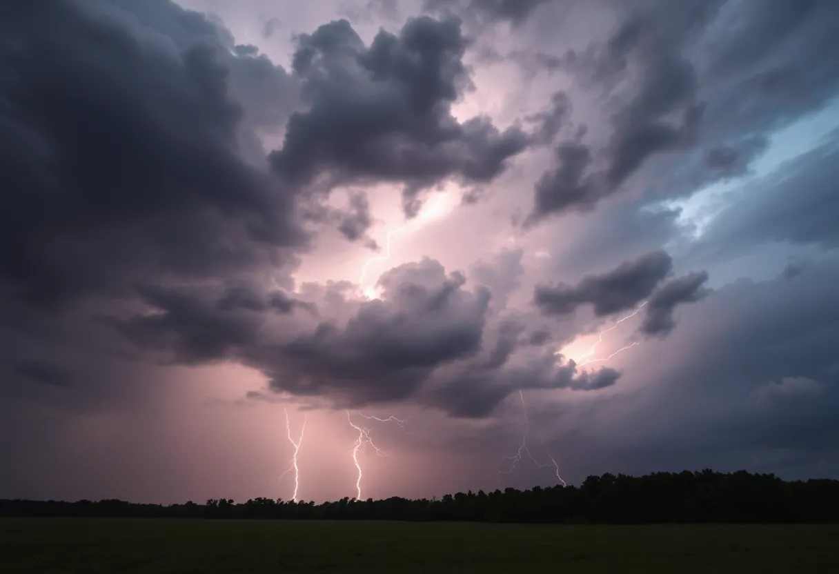
Nature’s Fireworks
Add to this mix the frequent earth-shattering lightning strikes that are happening. The lightning can be incredibly dangerous and can strike up to 10 miles away from the storm. It’s important to know that the risk of lightning tends to increase as a thunderstorm approaches. So if you hear rumbling, make sure you’re sheltered indoors!
Previous Warnings Expired
Interestingly, a previous warning for other counties like Bamberg, Calhoun, and Orangeburg was allowed to expire as the storm weakened. However, it’s a good reminder to stay vigilant because the weather can change quickly. Earlier in the day, another warning for Calhoun, Clarendon, and Orangeburg counties showed wind gusts similar to what we’re expecting now—up to a startling 60 mph! So, folks in Manning and nearby areas could see some damage to trees and power lines.
Looking Ahead
And guess what? The weekend might not be much better either. The Storm Prediction Center has indicated a slight risk for severe weather on both Saturday and Sunday. Thunderstorms carrying the potential for high winds and hail could pop up, so remain informed and alert!
Be Prepared!
As we navigate through these stormy skies, it’s essential to stay safe. If you’re outdoors when the storm hits, please seek shelter indoors. Moving to an interior room on the lowest floor of a sturdy building is your best bet. Keep an ear out for any updates from local news channels or weather apps so you can stay aware and prepared. This weather can be unpredictable, so let’s keep safety as our top priority!
Stay safe out there, South Carolina! We’re all in this together.
Deeper Dive: News & Info About This Topic
HERE Resources
Lightning Strike Injures 20 People at Lake Murray Public Park
Severe Thunderstorms Cause Widespread Damage in Columbia, SC
Tropical Depression 3 Develops Off the Southeastern U.S. Coast
Lightning Strike at Lake Murray Injures 20 People
Lexington and Richland Counties Under Severe Thunderstorm Warning
Lightning Strike Injures 20 at Dominion Beach Park
Lightning Strike Injures 20 at Lake Murray Park
Lightning Strike Injures 20 at Lake Murray Park
Lightning Strikes 20 at Dreher Shoals Dam
Brush Fires Prompt Evacuations in North and South Carolina
Additional Resources
- Herald Online: Severe Weather Update
- WACH: Midlands Brace for Thunderstorms
- WLTX: Severe Weather Potential for South Carolina
- Wikipedia: Thunderstorm
- Google Search: South Carolina Weather Alerts
Author: STAFF HERE IRMO
The IRMO STAFF WRITER represents the experienced team at HEREIrmo.com, your go-to source for actionable local news and information in Irmo, Lexington and Richland Counties, and beyond. Specializing in "news you can use," we cover essential topics like product reviews for personal and business needs, local business directories, politics, real estate trends, neighborhood insights, and state news affecting the area—with deep expertise drawn from years of dedicated reporting and strong community input, including local press releases and business updates. We deliver top reporting on high-value events such as the Irmo Okra Strut Festival, Harbison Community Events, and local sports tournaments at the Palmetto Health Credit Union Foundation Stadium. Our coverage extends to key organizations like the Irmo Chapin Recreation Commission and the Lexington Chamber and Visitors Center, plus leading businesses in retail and healthcare that power the local economy such as Village at Sandhill and Lexington Medical Center. As part of the broader HERE network, including HEREAiken.com, HEREBeaufort.com, HEREChapin.com, HERECharleston.com, HEREClinton.com, HEREColumbia.com, HEREGeorgetown.com, HEREGreenwood.com, HEREGreenville.com, HEREHiltonHead.com, HEREIrmo.com, HEREMyrtleBeach.com, HERENewberry.com, HERERockHill.com, and HERESpartanburg.com, we provide comprehensive, credible insights into South Carolina's dynamic landscape.