Columbia, SC, September 22, 2025
News Summary
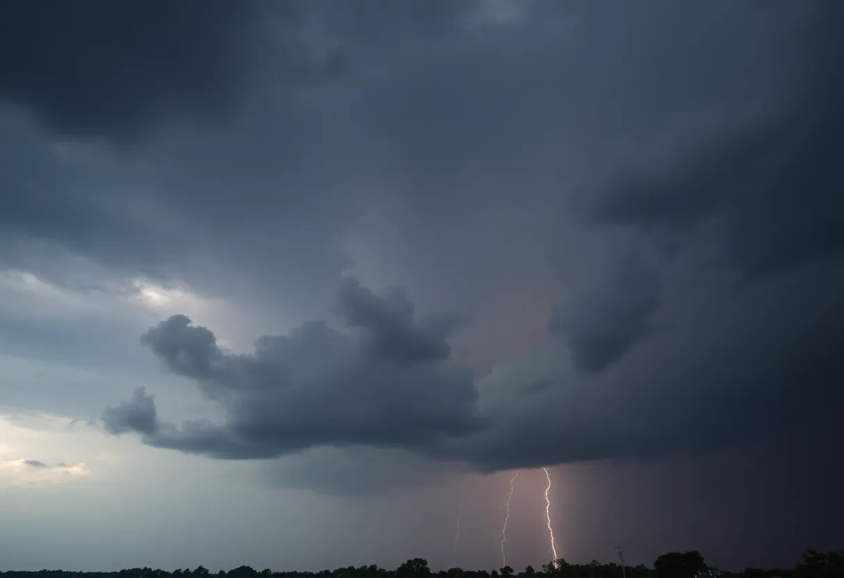
Columbia, South Carolina is preparing for severe thunderstorms expected to roll in late this week, with ominous forecasts predicting scattered storms and significant rainfall. Temperatures are projected to peak at 94 degrees on Wednesday, transitioning to a 60% chance of rain by Thursday night. The storms pose risks such as damaging winds, hail, and potential power outages, affecting both residents and outdoor plans. A Severe Thunderstorm Watch is in effect until midnight Thursday, urging residents to stay vigilant and prepared for rapid changes in the weather.
Columbia, SC Faces Severe Weather Threat with Thunderstorms Expected Late This Week
Columbia, South Carolina is gearing up for a weather adventure as we transition from a hot and dry stretch to a much stormier pattern starting Thursday afternoon. That’s right, folks! Thunderstorms are on their way, and if you’re in Columbia or the nearby areas, you’ll want to keep your umbrellas handy!
As we approach midweek, temperatures are sizzlin’ in the low 90s, with our peak expected to hit around 94 degrees on Wednesday. Enjoy that sunshine while it lasts because come Thursday afternoon, starting after 2 p.m., scattered storms are predicted to roll in.
Thunderstorms and Rain Alerts
Prepare yourself because the chance of rain will jump to a 60% likelihood by Thursday night. With these upcoming storms, be ready for brief downpours, gusty winds, and even some lightning. It’s a recipe for concern, especially for those commuting on the busy I-26 and I-20 highways.
The stormy weather doesn’t only affect weekday drivers; it’s also likely to throw a wrench into outdoor events. Areas such as Lexington, Irmo, and Cayce might see the heaviest rainfall from late Thursday into Friday morning. If you have plans, be aware that travel might slow down due to the wet conditions!
Weather Advisories and Preparation
Residents are strongly urged to keep an eye on weather updates, avoid any flooded roadways, and prepare for the possibility of power outages from the lingering storms. It might be a good time to check on your emergency supplies and make sure you have multiple ways to get severe weather alerts.
As we push into Friday, the unsettled weather isn’t going away just yet. Expect high temperatures to dip into the mid-80s as cloud cover increases and rain continues. Spotty showers may linger into Friday evening, causing a few more concerns for weekend plans.
Weekend Weather Outlook
So, how’s the weather shaping up for the weekend? Well, there’s good news! Conditions are expected to improve by Saturday, although some scattered showers may still stick around. A Severe Thunderstorm Watch is currently in effect until midnight Thursday for the entire WIS viewing area, so stay vigilant!
The primary threats include damaging winds with gusts reaching up to 60 mph, isolated large hail, and the potential for flash flooding. For those planning outdoor activities, keeping your plans flexible may be wise as conditions can change rapidly.
Residents should also note that there’s a slight risk for severe weather extending into Saturday and Sunday, with a Marginal Risk for strong to severe weather on Friday. Given the high temperatures in the low 90s and a saturated airmass, the likelihood of severe thunderstorms increases. So, don’t let your guard down!
Possible Effects and Community Preparedness
As the weather unfolds, keep in mind that severe storm cells might produce wind gusts exceeding 50 mph and hail up to half an inch. The risks associated with these storms may include potential power outages and disruptions in internet, phone, and cable services. Consider having a backup plan in case you find yourself without power.
Staying informed is key! Make sure to follow updates through your TV, streaming services, and social media. Weather changes can happen quickly, so being prepared is the best way to handle whatever comes our way!
FAQ
What should residents of Columbia, SC expect weather-wise later this week?
Thunderstorms are expected to impact Columbia and surrounding areas, with scattered storms forecasted after 2 p.m. on Thursday. Temperatures are projected to reach the low 90s through midweek, peaking at around 94 degrees on Wednesday under mostly sunny skies.
What are the specific threats associated with the upcoming storms?
The primary threats include damaging winds with gusts up to 60 mph, isolated large hail, and flash flooding. Spotty showers may linger late Thursday evening before the weather clears up overnight.
How can residents prepare for potential severe weather?
Residents are advised to monitor weather updates, avoid flooded roadways, and prepare for potential power outages due to lingering storms.
Weather Overview
| Feature | Details |
|---|---|
| Temperature Peak | 94 degrees on Wednesday |
| Storm Timing | Scattered storms after 2 p.m. Thursday |
| Rain Chance | 60% by Thursday night |
| Severe Weather Watch | Until midnight Thursday |
| Wind Gusts | Up to 60 mph |
| Hail Size | Up to half an inch |
Deeper Dive: News & Info About This Topic
HERE Resources
Beaver Dam Road in Irmo to Close for Road Work
Hough High School Remains Top Team in The Carolinas
Winter Weather Wreaks Havoc in the Midlands
Mid-Atlantic High School Football Rankings Announced
Central South Carolina Experiences Extreme Heat Wave
Columbia, SC Faces Severe Weather Alerts Including Tornado Warning
Irmo High School Yellow Jackets Secure Victory Against Butler
Charlie Kirk Fatally Shot at Political Event in Utah
Severe Weather Threat in Columbia, SC
Irmo Hosts Small Appliance Recycling Event
Additional Resources
- WLTX: Southeastern South Carolina Weekend Weather Forecast
- WISTV: Check Power Outages and See Damage from Wednesday Night Storms
- The State: Weather News Update
- WACH: Columbia SC Weather Blog on Thunderstorms and Damaging Winds
- The State: Latest Weather News
- Wikipedia: Weather
- Google Search: Columbia SC Weather
- Google Scholar: Weather Forecasting
- Encyclopedia Britannica: Weather
- Google News: Columbia SC Weather News
Author: STAFF HERE IRMO
The IRMO STAFF WRITER represents the experienced team at HEREIrmo.com, your go-to source for actionable local news and information in Irmo, Lexington and Richland Counties, and beyond. Specializing in "news you can use," we cover essential topics like product reviews for personal and business needs, local business directories, politics, real estate trends, neighborhood insights, and state news affecting the area—with deep expertise drawn from years of dedicated reporting and strong community input, including local press releases and business updates. We deliver top reporting on high-value events such as the Irmo Okra Strut Festival, Harbison Community Events, and local sports tournaments at the Palmetto Health Credit Union Foundation Stadium. Our coverage extends to key organizations like the Irmo Chapin Recreation Commission and the Lexington Chamber and Visitors Center, plus leading businesses in retail and healthcare that power the local economy such as Village at Sandhill and Lexington Medical Center. As part of the broader HERE network, including HEREAiken.com, HEREBeaufort.com, HEREChapin.com, HERECharleston.com, HEREClinton.com, HEREColumbia.com, HEREGeorgetown.com, HEREGreenwood.com, HEREGreenville.com, HEREHiltonHead.com, HEREIrmo.com, HEREMyrtleBeach.com, HERENewberry.com, HERERockHill.com, and HERESpartanburg.com, we provide comprehensive, credible insights into South Carolina's dynamic landscape.